General Information
Administrative Area Location
Disaster Response Center Contact
L
E
G
E
N
D
Administrative Area
Roads
Village Boundary Lines
Relevant Indicators
Relevant Indicators
Provincial Highway
County Road
Tsunami Shelters
Evacuation Direction
Earthquakes Shelters
Flood Shelters
Command Center
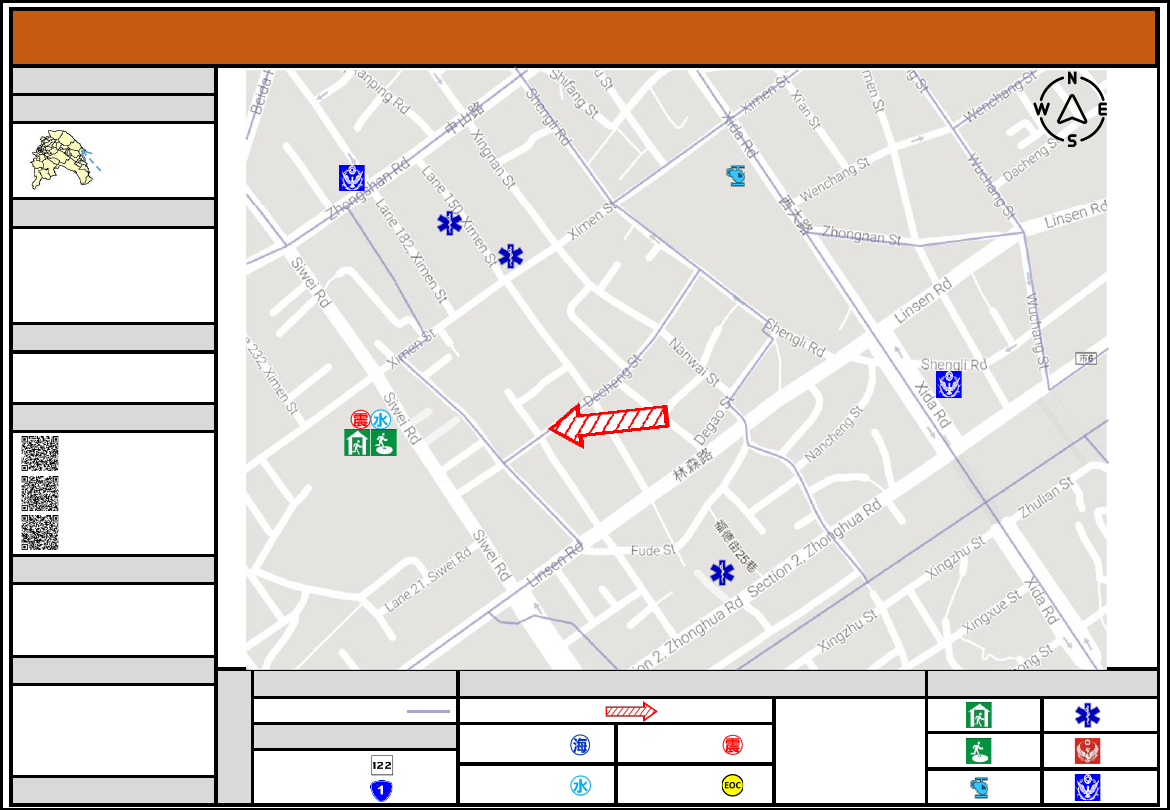
Evacuation map illustrates the various
landmarks, public facilities, evacuation
shelters; used only during big scale
disasters
and
during
mass
communication breakdown.
For
minor
disasters,
please
communicate
with
the
emergency
contact or relevant parties for more
information.
Indoor
Emergency
Shelter
Outdoor
Emergency
Shelter
Helicopter
Landing
Point
Medical
Unit
Fire
Department
Police
Unit
•
Hsinchu Disaster Response
Center
:
03-5283119
•
East District Disaster Response
Team
:
03-5218231
•
Dedicated Reporting Line
:
110, 119
Disaster Response Center Contact
Disaster Information Website
Evacuation Procedure Guidelines
Central Meteorological Bureau
Global Information Network
Hsinchu Fire Station
Water Resources Department
Disaster Prevention
Flood
:
Evacuate to floors 3 or higher. Tenants living
in first floor or below can evacuate to emergency
shelters.
Earthquake
:
During earthquake, do “squat, cover,
hold.” After earthquakes, go outdoors or to emergency
shelters.
Emergency Shelter
Hsinchu City GOV. Oct. 2022
Hsinchu City East District [Nanshi Vil.] Emergency Evacuation Map
Nanshi
Village
•
The Affiliated Experimental Elementary School of
National Tsing Hua University
No. 47, Siwei Rd.
03-5282420#301
WU,HUI-WEN (General affairs director)
•
Village Chief
:
TAN,TIENYI-I
•
TEL
:
0921-182083
•
Safety Message TEL
:
1991
Hsinchu City,
E. District
Nanshi Village
Ximen Police Station
Hsin Chung Shing Hospital
ShinSen Hospital
Hsinchu Cathay
General Hospital
Nanmen Police Station
The Affiliated Experimental Elementary
School of National Tsing Hua University
Far Eastern Department Stores